The Leonida Keys: Causeways, Reefs and the Southern Chain
A seaplane over turquoise shallows, a waterfront bar, a sea turtle on a wreck and a sandbar full of boats. What the Keys screenshots establish about the southernmost region.
The Leonida Keys are the island chain running south-west from the mainland, and they are the region Rockstar has used most often to sell the idea that GTA VI is not just a city game. Five official screenshots cover them, and no two of them show the same kind of place.
| Detail | Status |
|---|---|
| Named by Rockstar | Yes |
| Official frames published | Five |
| Real-world analogue | The Florida Keys — inferred, never stated |
| Named venue shown | The Rusty Anchor, a waterfront bar |
| Underwater environment | Shown — reef, wreck, sea turtle |
| Rockstar's framing | 'The dress code is casual, the bars are loaded' |
| Size or island count | Never stated |
Life in this tropical archipelago isn't flashy but it's easy. Get your buzz on and pull up a deck chair but look out - you are right on the doorstep of some of the most beautiful and dangerous waters in all of America.
Two of the named cast are tied to the region in Rockstar's own copy. Jason Duval was working for local drug runners in the Keys before the story starts, and Brian Heder still moves product through his boat yard there with his third wife, Lori. That is not scenery - it is where a protagonist's life was before the plot arrived.
In the heart of Leonida, American industry and old school values still reign supreme - whatever the cost. The Allied Crystal sugar refinery provides the jobs, while the local biker gang provides almost everything else.
That sentence answers the question the screenshots raise. Rockstar has told you what the local economy is - a sugar refinery - and told you who fills the gap around it. The biker club in the press shots is not decoration; the studio has explicitly placed it at the centre of how the region works.
The five frames
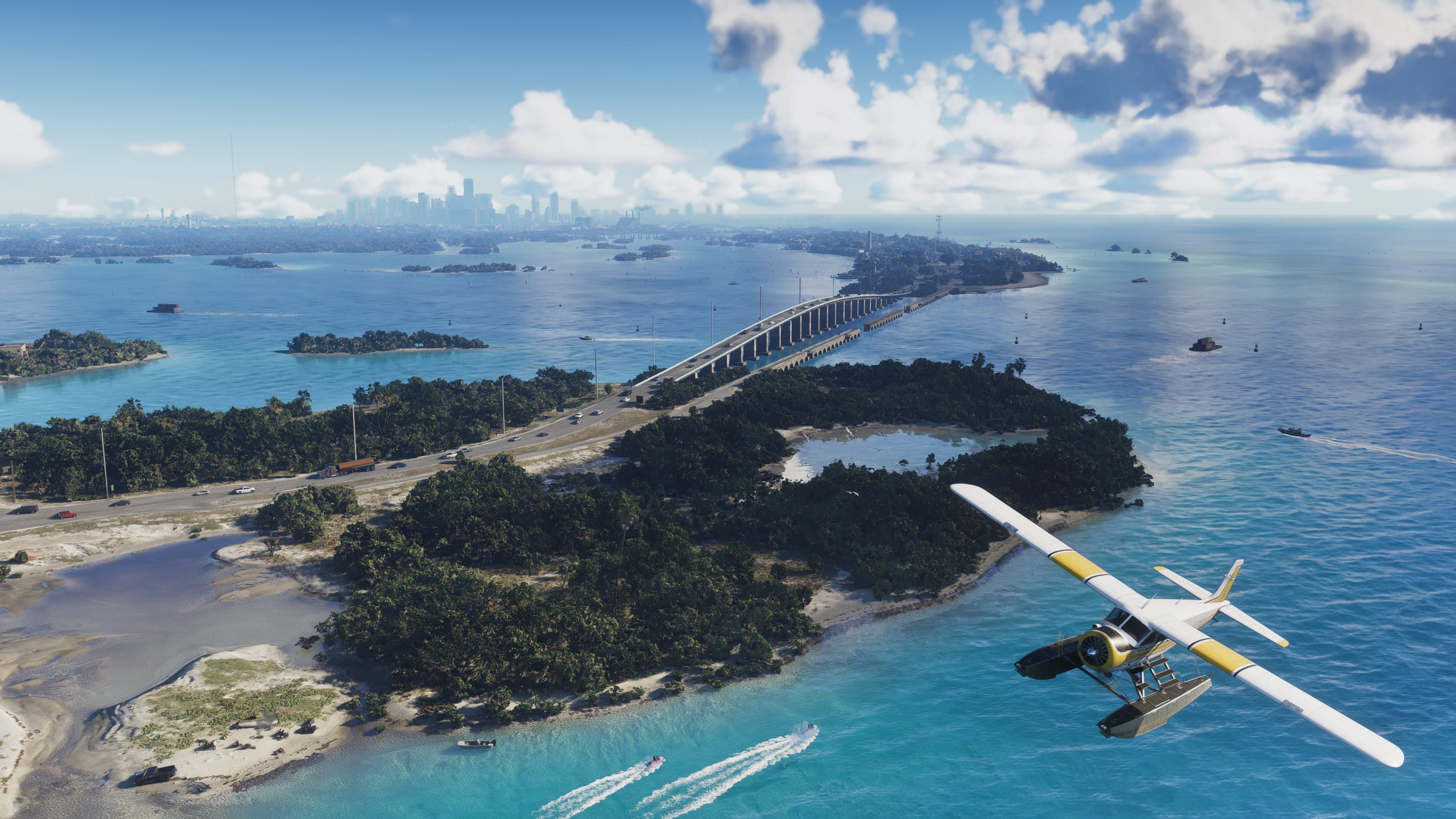
- A seaplane banking low over a causeway threading between turquoise shallows and small islands.
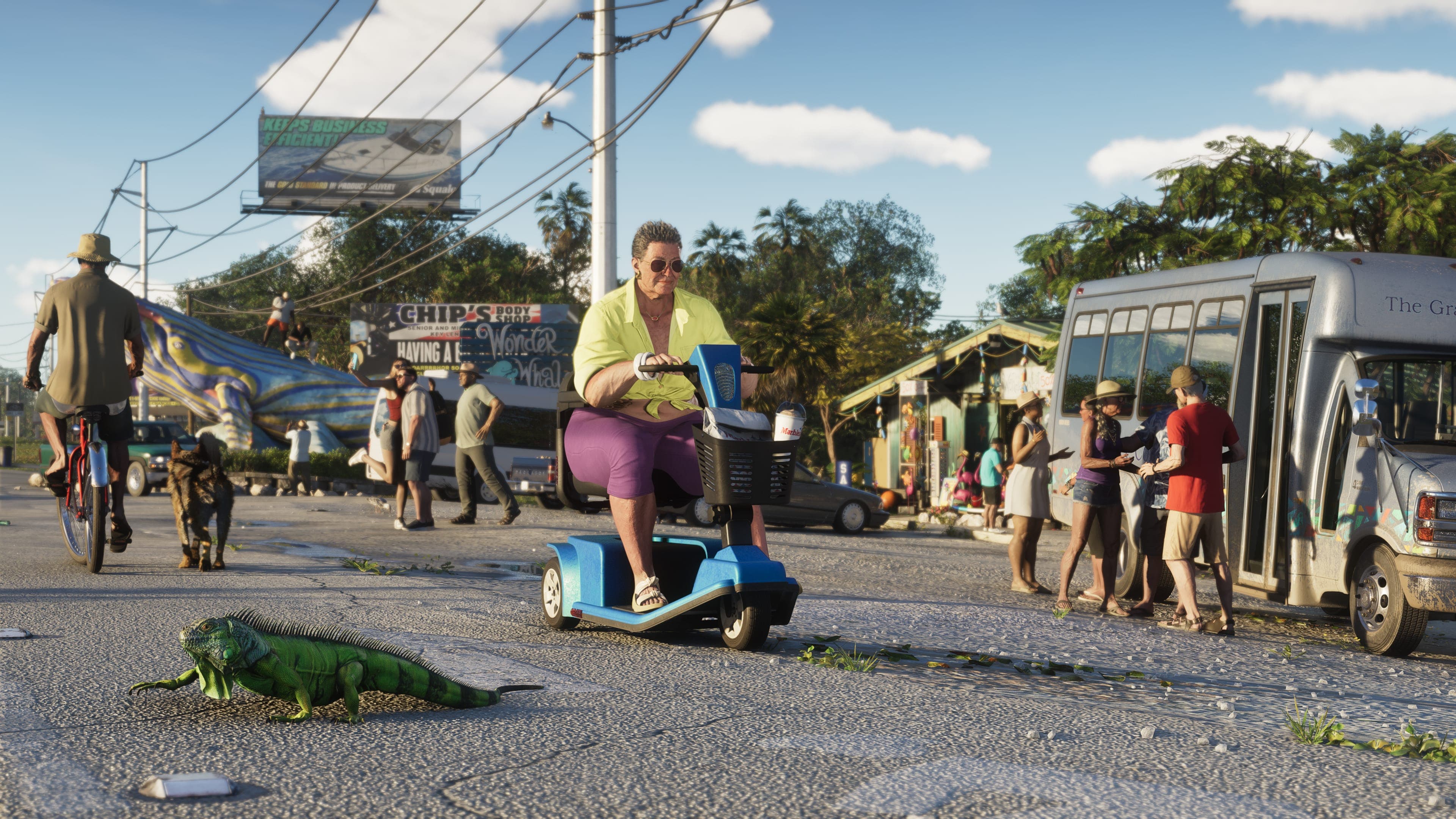
- A roadside scene with locals, a parked bus, a mobility scooter and an iguana on the kerb.
- The Rusty Anchor — a wooden waterfront bar with picnic benches under palms.
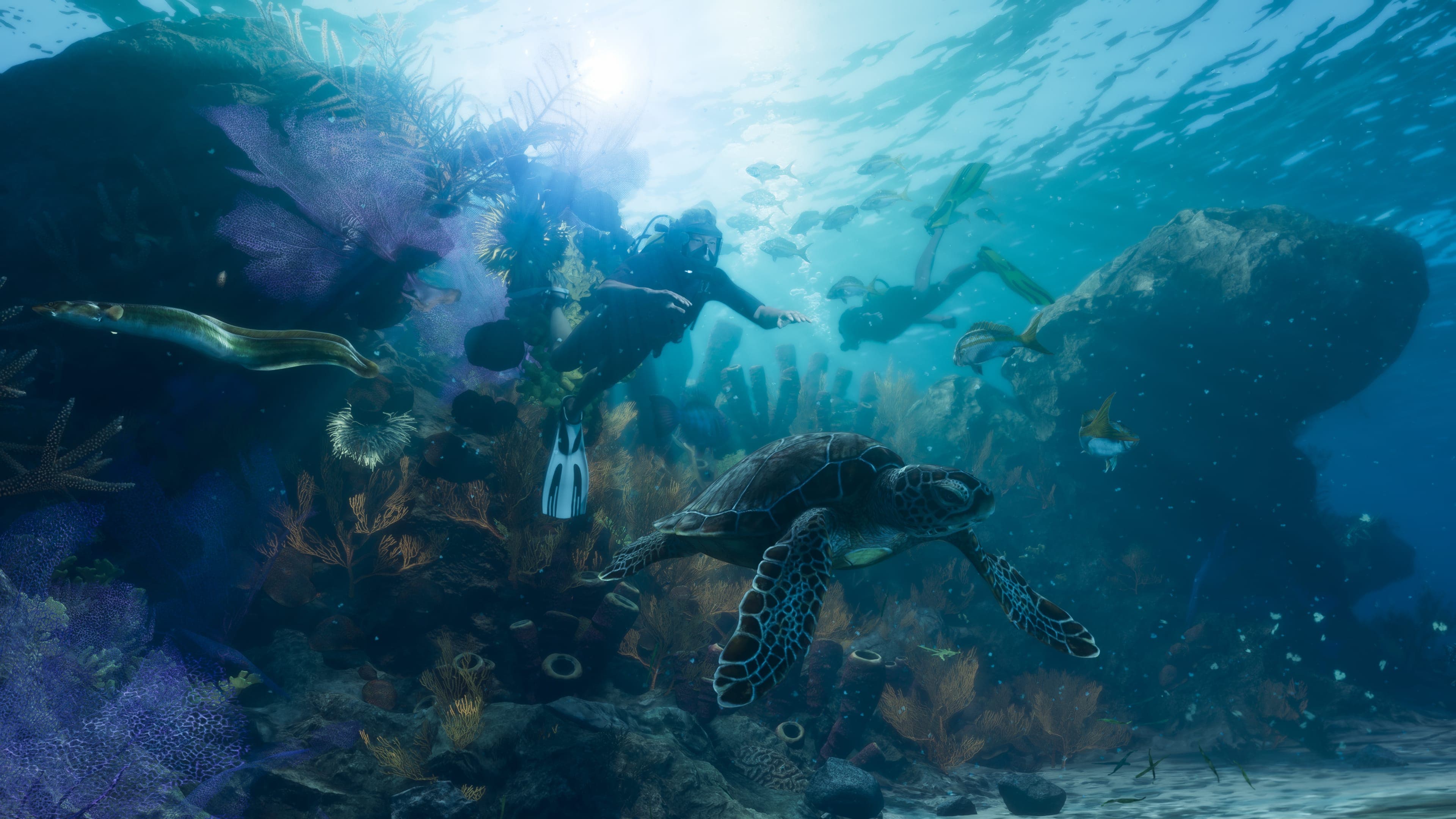
- An underwater reef with a sea turtle, shoals of fish and the remains of a wreck.
- Boats rafted together at a sandbar, with people swimming and sitting on inflatables between them.
That spread is doing something deliberate. One aerial for scale, one street-level frame for texture, one named venue, one underwater environment, one social scene. It is a region being introduced as a place people live rather than as scenery you drive through.
The underwater frame is the important one
Of everything in the Keys set, the reef screenshot carries the most weight. Rockstar publishing a fully composed underwater environment — with a wreck, distinct fish species and a sea turtle — is not something a studio does for a skybox.
| What the reef frame supports | Confidence |
|---|---|
| Underwater environments are modelled in detail | High |
| Swimming and diving are possible | High, by strong implication |
| Wrecks exist as discoverable locations | Moderate — one is depicted |
| There is an underwater collectible or salvage system | No evidence |
| Diving equipment or oxygen mechanics exist | No evidence |
GTA V had diving, wrecks and underwater collectibles, so the assumption is reasonable. Reasonable is still not confirmed, and Rockstar has said nothing about how any of it works.
The Rusty Anchor, and why named venues matter
Rockstar naming a bar in a press screenshot is a small thing that is worth noticing. Named venues in GTA maps are almost always functional — somewhere a mission starts, somewhere you can enter, or somewhere that recurs. Unnamed background buildings do not get their own frame.
That is an inference from how Rockstar has built maps before rather than a statement about GTA VI, and it should be held loosely. But if you are looking for places likely to matter in the Keys, the venue Rockstar chose to photograph is the obvious candidate.
What the Keys change about traversal
The practical consequence of an island chain is that the map has regions where a car is the wrong answer. Between the causeway, the seaplane and the sandbar frames, Rockstar has shown three different non-road ways of being in the Keys and only one road.
- A causeway implies a long, exposed single road — good for chases, bad for escape.
- Seaplanes appear in official material, though whether they are player-flyable is unstated.
- Boats are shown socially rather than as transport, which is a different framing from GTA V's.
- Underwater space is modelled, which adds a third dimension to a region that is mostly water.
A vehicle appearing in a screenshot does not mean it is drivable. Rockstar's press sets include plenty of background traffic and scenery aircraft, and the studio has confirmed no vehicle list.
What we still do not know
- How many islands the chain contains, or how far it extends.
- Whether the Keys are open from the start or gated.
- Whether there is a named settlement, or several.
- Whether the seaplane is player-flyable.
- Whether underwater areas contain anything beyond scenery.
- How the region behaves in storms — a Florida analogue with no weather system would be a strange omission, but none has been described.
The Keys as a story location
Rockstar has tied more of its published fiction to the Keys than to any region except Vice City, and none of it comes from the location pages. It is scattered through the character descriptions.
| Connection | Rockstar's wording |
|---|---|
| Jason Duval's pre-story life | 'He found himself in the Keys doing what he knows best, working for local drug runners' |
| Brian Heder's business | 'Still moving product through his boat yard with his third wife, Lori' |
| Brian's history | 'A classic drug runner from the golden age of smuggling in the Keys' |
| Cal Hampton's habit | 'Snooping on Coast Guard comms with a few beers' |
| Jason's housing | Rent-free at one of Brian's properties, in exchange for local shakedowns |
Three of the eight named characters are anchored here, including a protagonist. That makes the Keys the most narratively loaded region in the published material, which is not the impression the tourist-brochure regional copy gives.
Smuggling geography
Rockstar's own line warns that the Keys sit "right on the doorstep of some of the most beautiful and dangerous waters in all of America". Read alongside a boat yard moving product, a protagonist working for drug runners and a friend monitoring Coast Guard radio, the region has a clear function in the fiction.
- An island chain with a single causeway is a natural chokepoint, which matters for both smuggling and pursuit.
- Open water to the south is the standard route in every Florida crime narrative, and Rockstar's phrasing gestures at it without naming a destination.
- The Coast Guard is the only law-enforcement body Rockstar has named anywhere in its GTA VI material.
- A boat yard is infrastructure - somewhere vessels are stored, repaired and loaded.
None of that means smuggling is a mechanic. It means the region's fiction is built around it. Rockstar has described no cargo, contraband-running or interdiction system anywhere.
What the tone of the copy tells you
Rockstar gives each region a one-line hook, and the Keys got "the dress code is casual, the bars are loaded". Compare that to Port Gellhorn's "this is Leonida's forgotten coast" or Grassrivers' "the untamable jewel of Leonida's crown".
The Keys line is the only one written as an advertisement. The regional description follows the same register - easy living, deck chairs, a warning tacked on at the end. That contrast between surface ease and the water beyond it is the region's whole character, and Rockstar wrote it that way deliberately.
| Region | Rockstar's one-line hook |
|---|---|
| Vice City | 'We're a long way from the '80s, but Vice City is still the sun and fun capital of America' |
| Leonida Keys | 'The dress code is casual, the bars are loaded' |
| Grassrivers | 'The untamable jewel of Leonida's crown' |
| Port Gellhorn | 'This is Leonida's forgotten coast' |
| Ambrosia | 'The battle for the health and wealth of Leonida begins here' |
| Mount Kalaga | 'Room to breathe on the state's northern fringes' |
Read as a set, those six lines are the most compact summary of Leonida available - and the Ambrosia one is the only one that sounds like a plot.
Almost certainly, though Rockstar has never said so. The causeway, the shallows and the island chain are all direct visual references.
Rockstar has published a detailed underwater reef screenshot, which strongly implies it. No mechanic has been described.
It appears in an official screenshot with its sign visible. Whether it is enterable or mission-relevant has not been stated.
A causeway is shown, and boats and a seaplane appear in the set. Rockstar has not described how travel between regions works.
Not shown. The published underwater frame contains a sea turtle and shoals of fish.
Keep reading
Leonida Map: All Six Confirmed Regions
Vice City, Leonida Keys, Grassrivers, Port Gellhorn, Hamlet, and Kelly County - what Rockstar has said about each, and how the state fits together.
Read more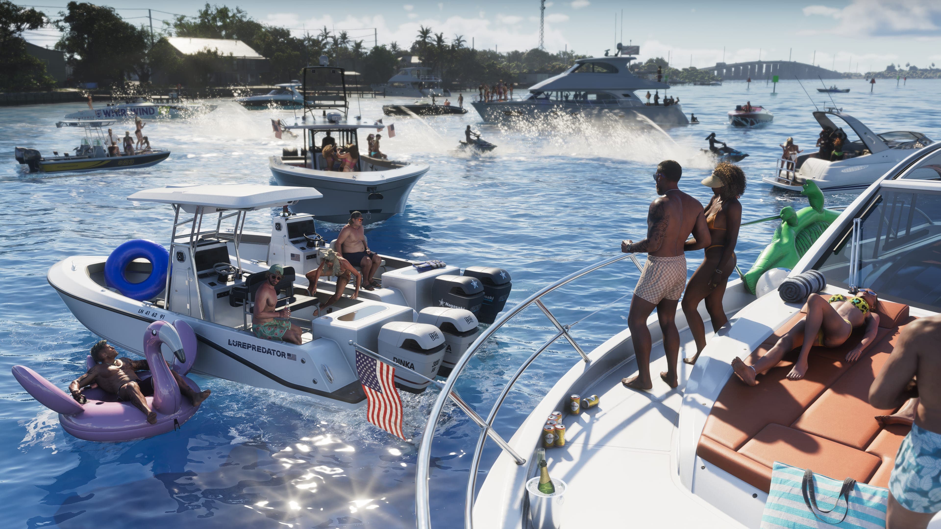
Boats, Airboats, and the Cargo Ship: Water Travel in Leonida
Two of six regions are navigated by water. Why that's a structural change for the series, and what Rockstar has actually shown.
Read more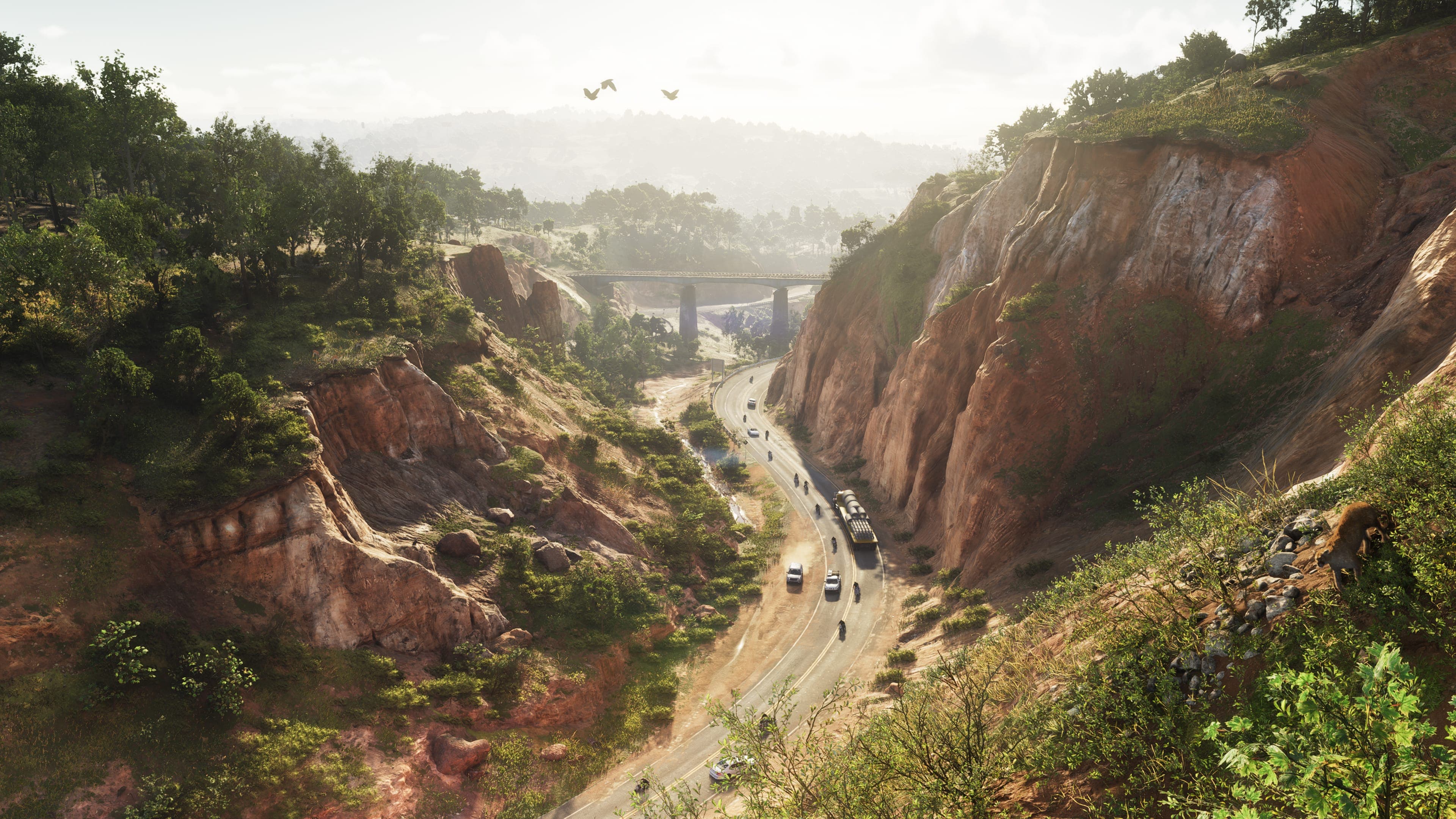
Mount Kalaga National Park: Leonida's Wilderness Region
Canyon highways, pine forest, bears at the riverbank and a helicopter over the ridgeline. What Rockstar's screenshots establish about the north — and why it does not look like Florida.
Read more